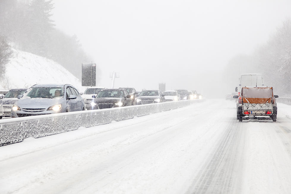
“Snow Bomb” Headed For Washington Cascades: Winter Storm Warning
The National Weather Service office in Pendleton, Oregon has issued some clear reminders that winter weather will soon be upon us. You should be prepared for winter driving conditions.
Snow is in the forecast for many parts of the state and there appears to be a 'Snow Bomb' headed for higher elevations as there is a Winter Storm Warning in effect for the Washington Cascades including Snoqualmie Pass.
10-Day Weather Forecast for Yakima Valley - 11/30 thru 12/7
National Weather Service
Thursday: A 30 percent chance of snow after 10 am. Patchy freezing fog before 7 am. Cloudy, with a high near 32. Light southeast wind.
Thursday Night: A 40 percent chance of snow before 10 pm. Cloudy, with a low of around 27. Calm wind.
Friday: Snow likely before 10 am, then rain and snow likely. Snow level rises to 2400 feet in the afternoon. Cloudy, then gradually becoming mostly sunny, with a high near 34. South wind 3 to 6 mph. The chance of precipitation is 60%. New snow accumulation of less than a half inch is possible.
Friday Night: Snow likely. Mostly cloudy, with a low of around 27. Southwest wind 6 to 8 mph. The chance of precipitation is 70%. New snow accumulation of less than a half inch is possible.
Saturday: Snow likely before 10 am, then a chance of rain. The snow level will rise to 3600 feet in the afternoon. Partly sunny, with a high near 44. The chance of precipitation is 60%. New snow accumulation of less than a half inch is possible.
Saturday Night: A chance of rain and snow before 10 pm, then snow. Low around 29. The chance of precipitation is 80%. New snow accumulation of less than a half inch is possible.
Sunday: Rain and snow, becoming all rain after 10 am. High near 44. The chance of precipitation is 80%.
Sunday Night: A chance of rain before 1 am, then a chance of rain and snow. Mostly cloudy, with a low of around 30. The chance of precipitation is 50%.
Monday: A chance of rain and snow before 10 am, then a chance of rain. Partly sunny, with a high near 45.
Monday Night: Rain and snow likely. Mostly cloudy, with a low of around 32.
Tuesday: Rain and snow likely. Mostly cloudy, with a high near 46.
Tuesday Night: A chance of rain and snow. Mostly cloudy, with a low of around 33.
Wednesday: A chance of rain and snow. Mostly cloudy, with a high near 46.
10-Day Weather Forecast for Snoqualmie Pass - 11/30 thru 12/7
National Weather Service - Winter Storm Warning
Thursday: Snow. High near 30. Southeast wind 6 to 8 mph. The chance of precipitation is 90%. New snow accumulation of 1 to 2 inches is possible.
Thursday Night: Snow. Low around 25. The southwest wind is around 8 mph. The chance of precipitation is 100%. New snow accumulation of 2 to 4 inches is possible.
Friday: Snow. The snow could be heavy at times. High near 32. Southwest wind 7 to 11 mph. The chance of precipitation is 100%. New snow accumulation of 8 to 12 inches is possible.
Friday Night: Snow before 10 pm, then rain and snow. The rain and snow could be heavy at times. Low around 29. Southwest wind 9 to 13 mph, with gusts as high as 18 mph. The chance of precipitation is 100%. New snow accumulation of 8 to 12 inches is possible.
Saturday: Rain and snow before 7 am, then snow between 7 am and 10 am, then rain and snow after 10 am. The snow could be heavy at times. High near 33. The chance of precipitation is 100%. New snow accumulation of 3 to 7 inches is possible.
Saturday Night: Snow. Low around 30. The chance of precipitation is 90%. New snow accumulation of 3 to 5 inches is possible.
Sunday: Rain and snow, becoming all rain after 10 am. High near 39. The chance of precipitation is 100%.
Sunday Night: Rain before 4 am, then snow, possibly mixed with rain. Low around 31. The chance of precipitation is 90%.
Monday: Rain and snow, becoming all rain after 10 am. Mostly cloudy, with a high near 39.
Monday Night: Rain. Mostly cloudy, with a low of around 34.
Tuesday: Rain. Mostly cloudy, with a high near 39.
Tuesday Night: Rain and snow. Mostly cloudy, with a low of around 32.
Wednesday: Rain and snow. Mostly cloudy, with a high near 37.
GET PASS REPORT AND WEATHER DELAY INFORMATION 24/7
READ MORE:
- Seahawks Coach Carroll is Confident. Seattle To Go Retro vs Cowboys
- Uncovering California's Unsolved Mysteries: Pt. 1 'The Toxic Lady'
- Robbery! My License Plates Cost Too Much in Washington State
- Rite Aids Closing in CA, WA, OR - Is Your Location Safe?
- CA Bans Gas-Powered Lawn Equipment: How Will It Impact OR and WA?
- Retirement Savings Goals in WA, CA, and OR for Financial Future
KEEP READING: Get answers to 51 of the most frequently asked weather questions...
More From News Talk KIT