Did The Douse From Mother Nature Help The Schneider Springs Fight?
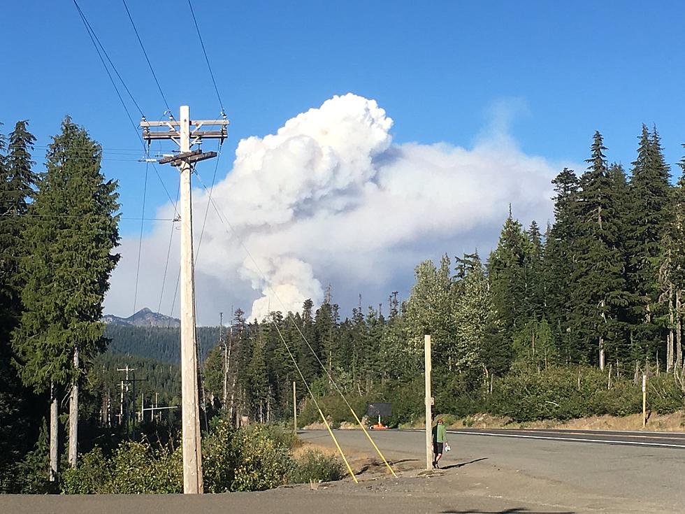
If you're wondering if Mother Nature helped douse the Schneider Springs Fire firefighters say they didn't increase containment but the fire grew under 100 acres between Saturday and Sunday.
CONTAINMENT REMAINS THE SAME AS FRIDAY BUT CHECK THE GROWTH
The fire is now at 31% containment.
The fire, which started August 3 by a lightning strike grew from 104, 800 acres Friday to 104, 853 acres on Sunday.
Officials with the Okanogan-Wenatchee National Forest say "scattered showers fell over the fire with the greatest amount around the eastern portion. Crews within the northwest area of the fire Sunday focused on building direct line south of Forest Roads 1709 and 1706. Additionally, crews continued to prep the American Ridge Trail near Highway 410. Firefighters will once again be patrolling in and around the communities of Cliffdell, Goose Prairie, and Bumping Lake to provide structure protection on Monday. Hauling of excess materials and mop up will resume along the Highway 410 corridor south of Cliffdell. Crews will continue patrolling the southern area of the fire. Areas of the fire within the wilderness will also be monitored into the new week."
NEW RESOURCES ARE ARRIVING EVERY DAY BUT THE NUMBERS ARE DOWN
There's a lot of people and resources on the fire but the number is shrinking. On Monday 671 resources were on the fire. The number Sunday is 525 which includes;
Crews (8); Engines (28); Dozers (4); Air Resources (3); Other Heavy Equipment (24)
The helicopters dumping water on the fire are based at the Yakima Airport and fly to and from the airport during the day for refueling.
RESIDENTS ARE STILL ON ALERT
Evacuation levels have not changed since Monday.
LEVEL 2: Bumping River Road corridor from north to south; Highway 410 corridor from Salmon Cove to Pinecliff; LEVEL 1: Highway 410 corridor from Pinecliff to the junction of U.S. Route 12, and from U.S. 12 at Hwy 410 west to Tieton Reservoir Rd. See map at Yakima Valley Emergency Management: https://www.facebook.com/YakimaCountyOEM . Sign up for alerts at Yakima County geo-specific emergency alert system: https://www.yakimacounty.us/2222/Alert-Yakima
Closures: An area closure for National Forest System lands is in effect. The closure order and map are available at https://inciweb.nwcg.gov/incident/closures/7775/. Campfires are prohibited throughout the Okanogan-Wenatchee National Forest. All Washington Department of Natural Resources managed lands in the fire area are temporarily closed, more at: https://www.dnr.wa.gov/dnr-closure-eastern-2021. A Temporary Flight Restriction (TFR) is in place over the fire area. If You Fly We Can’t Fly https://knowbeforeyoufly.org/home.
Firefighters are hoping for full containment by October 1 but the fight continues until that date.
What Are the Signature Drinks From Every State?
LOOK: Best Beers From Every State
More From News Talk KIT


